 Go to main content
Archive Website of the UK government
Please note that this website has a UK government accesskeys system.
Main menu
Page menu
Environment and greener living

Public rights of way
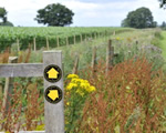
Public rights of way are public highways that are legally protected in the same way as roads. There are four different types of public rights of way, allowing different activities. Find out about your rights and what to do if you have problems using a public right of way.
What is a public right of way?
There are certain routes across Britain that you have the right to walk along. These routes may be roads, paths or tracks, and can run through towns, remote countryside or private property. They are open to everyone at any time and are known as public rights of way or, simply, rights of way.
As well as walking, some rights of way are open to horse-riders, cyclists or motorists.
The local highway authorities in England and Wales keep legal records of rights of way, showing where they are and their status.
Types of public rights of way
There are four different types of public rights of way. These may be marked along their route with signposts and coloured arrows:
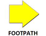
footpath (yellow arrow) – open to walkers only
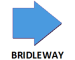
bridleway (blue arrow) – open to walkers, horse-riders and cyclists; cyclists must give way to walkers or horse-riders
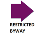
restricted byway (plum-coloured arrow) – open to walkers, cyclists, horse-riders and horse-drawn vehicles
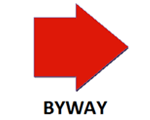
byway open to all traffic (red arrow) – open to walkers, cyclists, horse-riders, horse-drawn vehicles and motor vehicles
How to find rights of way
You can find rights of way in your area by looking at Ordnance Survey (OS) maps. The most useful OS maps are 1:25,000 scale – these show all public rights of way and permissive paths in green. The 1:50,000 OS maps show public rights of way in red. The OS website has downloadable guides to map symbols.
You can also find rights of way through guide books and local council websites. English and Welsh local councils must record the existence and locations of rights of way and make sure this information is available for public use.
When you’re out and about, rights of way are often signposted with coloured arrows.
Problems in using a right of way
If you have a problem using a right of way – for example, an obstruction, poor maintenance or a misleading sign – you should report it to:
- the National Park Authority if it’s in a national park
- the local highway authority for land outside national parks – you can contact them through your local council
- the Forestry Commission in woodland
Local authorities, landowners and land occupiers all have a duty to keep public rights of way open and useable.
Rights of way in Scotland
In Scotland, a right of way is treated differently to those in England and Wales. A Scottish right of way is any route over which the public has been able to pass for at least 20 years. The route must link two public places, for example, a village, church or road.
Unlike England and Wales, Scottish local authorities don’t have to signpost or mark a right of way. The charity ‘Scotways’ helps record and sign routes.
The Scottish Outdoor Access Code gives guidance on how to behave responsibly in the Scottish countryside.
Permissive access
Some landowners may let you access their land for walking, cycling or horse-riding. This is known as permissive access.
Types of permissive access and how to find it
Some farms provide educational access to schools, families and other groups for study purposes or general interest. Natural England’s website has details of these farms, as well as conservation walks and rides.
You can also access some land of outstanding scenic or scientific interest – the HM Revenue & Customs directory lets you search for these properties.
On OS maps, permissive access is marked with orange broken lines.
Restrictions on permissive access land
Some permissive access areas may be closed at certain times of the year to protect sensitive sites – for example, when rare birds are nesting.
You can usually take your dog on permissive access land, but it must be kept on a short fixed lead at all times. Sometimes, for example during lambing season, dogs may not be allowed.
Open access
Open access is another way in which you can enjoy the countryside. To learn more about this, have a look at ‘Open access to the countryside’.
 Facebook
 Twitter
 StumbleUpon
 Delicious
 Reddit
